


| Distance | 80.76 kms | 50.33 miles |
|---|---|---|
| Climbed | 963 meters | 3,159 feet |
| Ride time (hours) | 5.54 | - |
| Avg speed | 9 kph | - |
| Avg climb | 3% | - |
| Max grade | 7% | - |
| Distance | 29,857.22 kms | 18,552.27 miles |
|---|---|---|
| Climbed | 311,745 meters | 1,022,785 feet |
| Ride time (hours) | 2,106.38 | - |
Saturday, June 14th, 2014
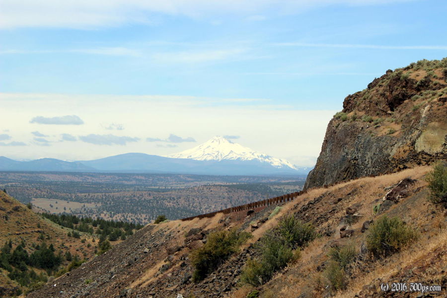
From Madras my route turns to the northwest. I figured this would mean riding right into the teeth of a strong headwind; I am not mistaken. I cheer myself up with a big diner breakfast before I head out into the bluster. Jerry in Bend had warned me about the big drop then climb out of the Deschutes River canyon. The climb out normally wouldn't be too bad but the wind makes it a challenge. I'm in the Warm Springs Indian Reservation for most of the day, replete with casinos of course, that venerable institution that seems to have become the hallmark of any reservation.


At the top of the climb out of the canyon the road stretches across a long, treeless plain where the wind is free to let loose without impediment. I just keep turning the cranks, hopeful that the trees far in the distance will eventually provide some cover. The satellite view of today's ride shows the sharp contrast between the grey of the plain and the green of the forest.

When I catch up with the trees they do provide cover but the road turns upward, leaving me to continue on at the same snail's pace that I've been nursing most of the day. The waning afternoon is all about getting off of reservation land before camping. There's a junction, the road takes a more westerly course, and my map shows the north side is National Forest and the south side is reservation. It's cloudy up here, bringing significantly lower temperatures and the threat of rain. I hurry up my campsite selection just in case the clouds make good on that threat. Down a path I find a clearing with flat ground, here I pitch the tent, make dinner, and get cozy in the bag just before it starts to drizzle. Tomorrow night should see me in Portland.


