


| Distance | 127.10 kms | 78.91 miles |
|---|---|---|
| Climbed | 710 meters | 2,329 feet |
| Ride time (hours) | 6.69 | - |
| Avg speed | 19 kph | - |
| Distance | 1,158.64 kms | 720.17 miles |
|---|---|---|
| Climbed | 8,952 meters | 29,370 feet |
| Ride time (hours) | 89.80 | - |
Wednesday, November 1st, 2017
It is cold this morning. I'm up packing at dawn, until I realize there is dew on the tent. I leave it up to wait for the sun to clear the mountain to the east so it can dry. Steve is making coffee next door. A great way to start this cold morning, with a piping hot cup of coffee. I never carry any because I'm too anxious to get on the road in the morning to bother with the stove and whatnot. We sip from our cups and continue last night's conversations as the sunshine slowly makes its way down the big rock formation in the center of the campground. When it hits us the character of the morning changes completely, off come the jackets and on with the willingness to tackle the day's ride.


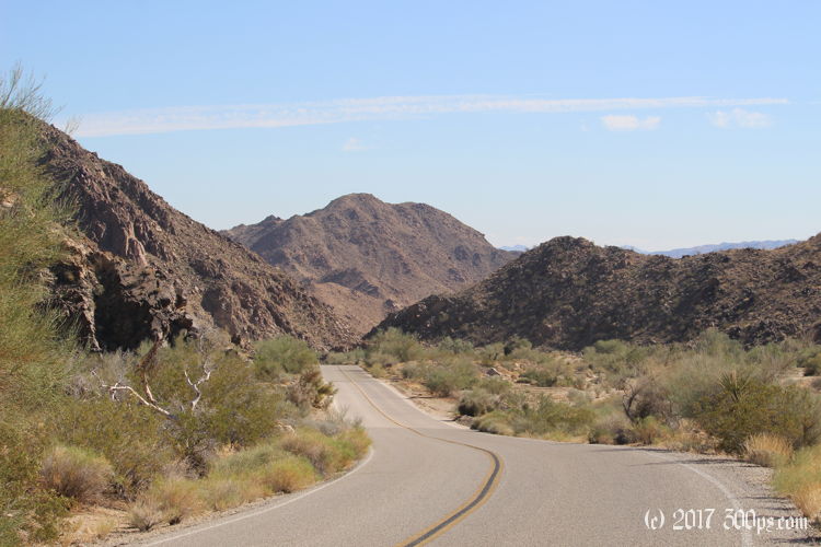
I throw the dried tent in its sack, load the bags, then say my goodbyes to Steve and Maureen with promises to stay in touch. I've got a climb to start the day, still wearing my fleece against the morning chill, until the sun asserts itself as I near the top. Next I'm on a long descent down into the Pinto Wash valley. The south wind is not in my favor but I needn't worry about it on the downslope. I pass Cholla Gardens, a place I remember hiking through the last time I was here. There's been no lack of chollas in my life the last few weeks so I skip it this time.


On the valley floor I'm looking at a long climb into the wind. I stop for a bite to eat to reinforce my morale, then start chugging along. If memory serves me correctly I just have to get to Cottonwood Springs then the climbing will be done for the day. I'm almost to the visitor center when Steve and Maureen come along in their van. We chat for a few minutes until a ranger comes along in the other direction. At the visitor center I chat with a guy from Philidelphia who says he has shipped his BMW R1150GS out here so he can explore the southwest for a few weeks. Allied Shipping brought it out, on a pallet in a truck. I tell him the story of how Lufthansa Cargo drove a forklift through my fairing when I flew my bike to Germany.


Just a short climb after the vistor center, then I'm looking at 25 miles of downhill, from over 3,000 feet of altitude to below sea level at Salton Sea. It doesn't feel quite as easy as it should because I've got a strong wind in my face, but I enjoy it all the same. Out of the park, I cross I10 and enter Box Canyon. I remember what a tough climb it was in the other direction when I came through here in 2014. The wind wasn't in my favor that day either...


When I arrive in Mecca (a town on the north side of the sea), I check my phone for camping options. The state campground is 10 miles away and their website says they have hiker/biker sites. I'm not in the mood to look for a stealth spot in this agricultural area so I head south towards the state park.


It's late enough that no one is working at the gate, but I see a sign that says hiker/biker camping is 5 dollars. Pretty good deal. I grab one of those self-pay envelopes, I'll pay tomorrow morning. I cycle down to the campground and run into the camp host on my way. He says I've got the place to myself, pick any site I like. It's already dark when I'm setting up the tent. I make dinner and crash early.

