


| Distance | 60.00 kms | 37.28 miles |
|---|---|---|
| Climbed | 727 meters | 2,385 feet |
| Ride time (hours) | 5.80 | - |
| Avg speed | 10.3 kph | - |
| Distance | 1,507.39 kms | 936.41 miles |
|---|---|---|
| Climbed | 10,896 meters | 35,748 feet |
| Ride time (hours) | 116.87 | - |
Tuesday, November 7th, 2017
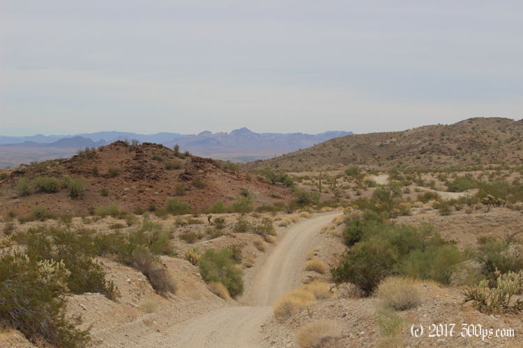
So the plan for the day is to start making my way towards Alamo Lake. I've pieced together a rough itinerary of paved and unpaved roads, then trails to more unpaved roads using OSMAnd. The morning does hold one pleasant surprise: the first 15 miles of Shea Road are paved. I wasn't expecting that. At a canal the pavement stops. This is my last sure-thing water source until I reach Alamo Lake. There may or may not be cattle troughs along the way but I can't count on them. I ignore the ominous signs, jump the fence, and filter enough water to leave with 8 liters. With the lower temperatures I'm hoping that this will see me through the (hopefully only) two-day ride to the lake.


Shea Road is nicely graded until the turnoff for Planet Ranch, then it gets uglier. I meet a woman here in a white pickup with government plates who asks me if I'm okay. Yup, I do this all the time. Be safe then, she says. I think there is some kind of mine up the road she has come down. She will be my last human sighting of the day. The reason the road has gotten uglier is that it's heading straight up a wash. A wash means thick sand, that coupled with the prolonged climb makes for a slow slog. I reach a crossroads, there's that Arizona Peace Trail sign again. I guess I'm going to be following it for a while. I turn north towards Planet Ranch. Here the road goes a lot faster, even though at times it's in a wash, because it's mostly downhill.


Planet Ranch is a mix of newish-looking houses (3 of them) and ruins. I don't see anyone around. I spy a cattle trough in the distance but I don't check it out because I'm still okay with water. I traverse the Bill Williams "River" (read wash, no water here) on County Highway 133. The road climbs up the other side of the "river" basin and meanders north through a gate. BLM Signs are everywhere in front of the washes and side tracks saying "closed". This is private property, they seem to be working on some kind of reclamation project.


Continued on next page.

