


| Distance | 64.79 kms | 40.39 miles |
|---|---|---|
| Climbed | 1,121 meters | 3,678 feet |
| Ride time (hours) | 5.66 | - |
| Avg speed | 7.1 kph | - |
| Avg climb | 4% | - |
| Max grade | 14% | - |
| Distance | 26,854.91 kms | 16,686.92 miles |
|---|---|---|
| Climbed | 281,691 meters | 924,183 feet |
| Ride time (hours) | 1,906.54 | - |
Saturday, May 3rd, 2014
Some time in the middle of the night I wake up with a bad case of the hungries. I try to ignore it but it's no use, I have to eat something. Then I can't get back to sleep. Having just a sandwich last night wasn't such a good idea. The fitful sleep makes for a late start in the morning.
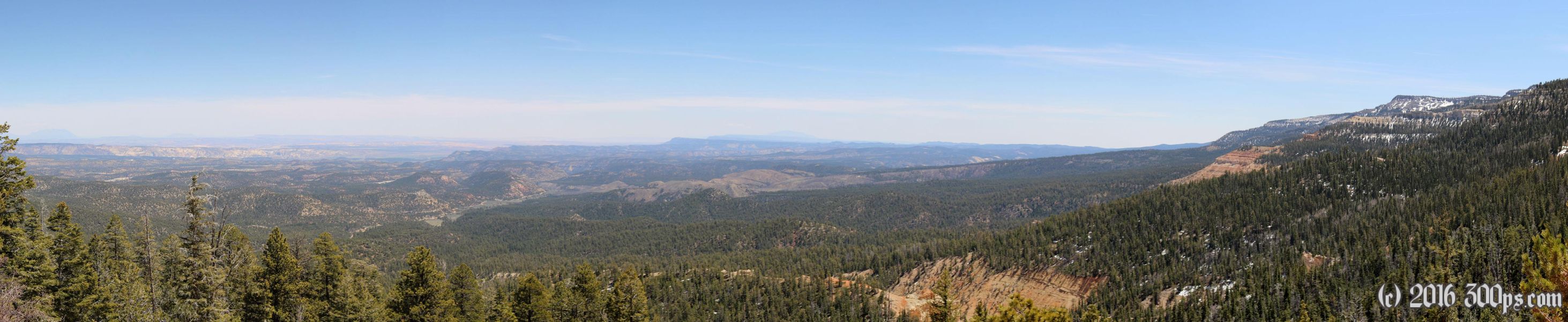
This morning offers up a continuous climb from 6,700 to 9,300 feet on a dirt road. It's a tough climb, with significant distances of 10 percent grades into the wind, but as dirt roads go this one has a good surface.


Up at the top it's pretty cold. I have lunch and consider my next move: I could go down the other side to Widstoe or head up a track that follows the ridge to Pine Lake. I take a better look at the track and decide against it. There are fallen limbs blocking it at various places; it looks like more adventure than I was after today.

The descent is rougher than the climb. There is a lot more loose gravel on this side. Widstoe is more like a village than a town, with no services that I can see, so I continue on until I hit the paved road that will take me into Bryce Canyon.


The wind is nasty on this road, right in my face, and today I don't have the equanimity to take it in stride. Interesting how some days the wind doesn't bother me but on others it drives me mad.
I arrive in Ruby's Inn tired and cranky. I continue on to the Bryce National Park, the visitor center and the fee booths are closed. I check out the campground... full. I suspected as much being 6 o'clock on a Saturday. I flag down a ranger to ask what my options are. She says just a mile back down the road is National Forest land. Back to the forest it is, but first I need water. I go back to the visitor center but the water fountains aren't working. Back to the campground then. Here I fill up and take off into the forest.

I find a site with a fire ring already set up and a stack of wood beside. I don't like the fact that it's located right next to a dirt road that looks well-used but I only have a half-hour of daylight left and I'm knackered.
I get the fire going, make supper, and hang out trying to stay warm.


