


Friday, September 8th, 2017
My neighbors were being noisy last night. I didn't come in to the back country to share close quarters with other campers so I'm packing up and heading somewhere more remote. Ely Creek looks promising; a trail that heads up through a canyon onto a plateau. I stop at the waterfall to filter as much water as I can carry since I don't know what the availability will be up top.


The trail looks like it doesn't get all that much use. There are some overgrown sections where it passes along and across Ely Creek, and some areas where the sagebrush is reclaiming its territory. The climb gets progressively steeper as the canyon narrows. I stop to set up the tent in a copse of trees with relatively flat ground, then continue on up carrying just my food in the backpack.


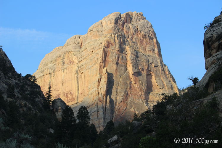
The trail gets very steep where it makes the final climb up out of the canyon and onto the mesa. I'm huffing and puffing when I reach the top... to find the perfect campsite just on the edge of the cliff overlooking the canyon. I'm bummed I already set up the tent, but since I'll probably have to go back down into the canyon to get water at the end of the day I might as well grab the tent and camp up here.


I continue on over the plateau through scrub pine and oak trees, then out into grasslands.


Cattle have spent some time up here grazing and have made the trail tough to follow with their competing tracks branching off in every direction. I'm pretty sure I've lost the path by the time I'm across the plain and into more hills. I decide to give up on reaching Island Park, I'll just climb up to the tallest hill so I can get a good view of the Green River.


Back at the top of Ely Creek Canyon I empty out the contents of my backpack and hang it from a tree so I won't have to carry it all down and back up. Going down the switchbacks is actually tougher than coming up; the loose rocks and steep grades make for a slippery ride. I fall on my butt a couple of times. I get to the creek and filter enough water for the night (the four liters I left the waterfall with this morning are long gone), repack the tent, and climb up the trail again. All this back and forth is worth it to camp on the edge of the cliff.


Rain squalls with heavy winds fly through at sunset but they don't last long. The wind dies and the stars come out at night in all their glory. I spend 20 minutes just staring up at them in fascination until my neck hurts.
Stats for hike (Strava data):
Miles hiked: 12.0mi
Elevation gain: 3,406 feet
Moving time: 5:04:09

