


Friday, August 4th, 2017
I take a day to go to the library and sort out the switch issue. A BMW dealer in Spokane orders it for me but it will take 5 days to come in. I ask them if they'll install it and they say they won't work on anything as old as a '92. What? First time I've heard that. Lame. At any rate I've got the part on the way. I spend the rest of the day on the internet, shopping, then swimming and lounging on the river beach near the campground.
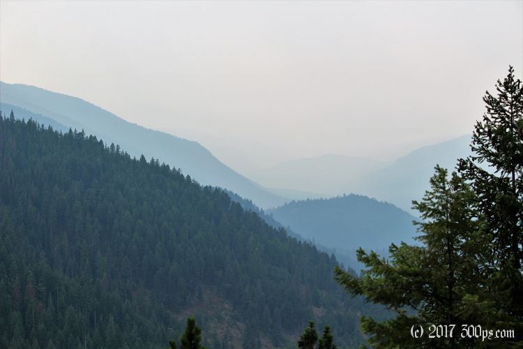
Next day: back to hiking. There's a trail that leaves right from the campground, too tempting to pass up. There's going to be a lot of elevation gain from what I can see... maybe not such a good idea to do with all this smoke but I want to get a better feel for this area. It's very hot, I'm guessing mid-90's, so I leave with 4 liters of water in my pack.


These massive pine trees are impressive. I've done some tree work, taken down what we would consider big trees on the east coast, but they are nothing compared to these towering conifers. I would be nervous trying to cut one down. The forest is bone-dry except for where the streams run. I can see how it would easily catch fire. My throat is slightly sore from breathing in all this smoke wafting through the mountains.


The trail is nothing but uphill for 7 miles. I gain close to 4,500 feet in that distance, a good clip. I'm sweating and tired by the time I reach the summit (which is pretty anticlimactic by the way, no view, just a forest service road and a sign saying this is the top). I eat my lunch, down a bunch of water, and try to get a picture of a buck I get a glimpse of in the woods. He's playing shy though. Now it's time to head back down.


I'm out of water before I even get back to Cascade Falls. I could drink straight from the stream but better to go thirsty for another mile and a half of downhill rather than risk getting sick.


I go straight to the well as soon as I arrive in the campground to down a liter of deliciously cold water. Then I head for the river to swim. That hike is a good workout. It has taken me most of the day to get up and down. I didn't see another soul the whole hike, not too surprising given the heat and the smoke.

Stats for hike (Strava data):
Miles hiked: 14.8mi
Elevation gain: 4,428 feet
Moving time: 5:13:07

