


| Distance | 38.00 kms | 23.61 miles |
|---|---|---|
| Climbed | 785 meters | 2,575 feet |
| Ride time (hours) | 6.63 | - |
| Avg speed | 5.8 kph | - |
| Distance | 637.04 kms | 395.81 miles |
|---|---|---|
| Climbed | 5,000 meters | 16,404 feet |
| Ride time (hours) | 55.95 | - |
Wednesday, October 25th, 2017
There was a lot going on in the neighborhood last night. I'm camped at the intersection of two canyons, anything going up or down either of them has to go by me. The traffic is heavy: rustling bushes, padding in the sand, somebody is chasing someone else, a screech, a wail, etc... I figure there's nothing out here I need to be worried about as long as I'm in the tent so I put in earplugs and went to sleep.
First thing in the morning (I'm up at the crack of dawn) is to walk up Piute Canyon to get water. I don't have to go far, one of the puddles I saw yesterday opened up overnight into a fairly large, clear pool. I filter straight from that. I wanted to go up to see the springs but the canyon is overrun with vegetation and I don't feel like bushwacking.
After a cursory breakfast I carry half of my gear on foot up out of the canyon onto the trail the map calls "Old Government Road". Zero resemblance to a road, it's just a foot path through and over the rocks. Next I carry up the bike with the other half of my gear on it. I can see that I am facing a major struggle to get over the Piute Range into the next valley. It's only 2.5 miles but it takes me almost 2 hours of painfully lugging the bike up the trail over the mountain. A couple of times I have to unload the bike, carry the gear over an obstacle, go back for the bike. It occurs to me how foolish I must look, but thankfully there is no one around to see. It's totally crazy to be doing what I am doing but I confess that I'm having a blast.


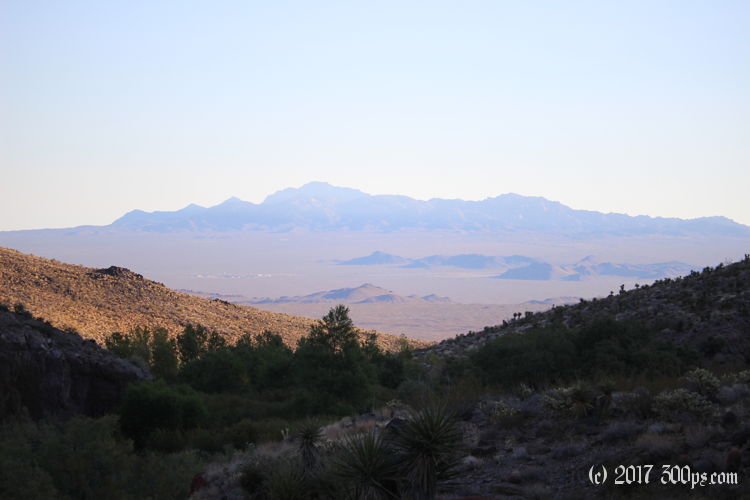
I'm elated when I finally reach the top. I've got spectacular views looking east over the valley I traversed yesterday, west looking down on the valley I will cross today, and mountains to the north and south. I stop here for a second breakfast and to appreciate the scenery.


When I get down to the valley floor it's 10:30am, the sun is high and hot. I start riding Mojave Road -- alternately rocky and sandy -- but it feels like easy living after my morning of dragging the bike by hand. Lowering the tire pressure to 30psi allows me to get through most of the sandy washes but I'm still walking occasionaly.


Continued on next page...

