


| Distance | 48.00 kms | 29.83 miles |
|---|---|---|
| Climbed | 702 meters | 2,303 feet |
| Ride time (hours) | 6.39 | - |
| Avg speed | 7.6 kph | - |
| Distance | 599.04 kms | 372.20 miles |
|---|---|---|
| Climbed | 4,215 meters | 13,829 feet |
| Ride time (hours) | 49.32 | - |
Tuesday, October 24th, 2017
The coyotes were out and about last night. I could hear them padding around on the soft sand of the road next to my tent. At dawn they are still calling to each other. I saw a few jackrabbits yesterday, that's probably what they are hunting. The wind never let up last night. It's still blowing like a banshee this morning... that doesn't bode well for my necessary detour up 95 to get water.


I have to walk the bike for most of the 2 miles or so that I have left to get over the pass. The sand is just too thick to ride. I'm thrilled when it turns to packed dirt and rock near the top, from here on down to highway 95 I'm able to ride (although with care, it's pretty rough). I arrive at the highway a little after 10am. I have a debate with myself about continuing down Mojave Road or just ditching this idea and heading north or south. I ride down the road a bit on this side to see how sandy it is. Doesn't look too bad, I'm going to go for it. But first I need water. I have 1.5 liters left of the 8 I was carrying out of Fort Mojave. There's only one option in the area: a gas station about 6 miles north. I leave one liter behind a bush and get on the highway. The wind is vicious, I'm just crawling along the whole way. It takes me 1.5 hours to get to the gas station. I buy 2.5 gallons and a bag of Cheetos: 11 dollars. Ouch. Well I suppose their costs are high out here in the middle of nowhere. I chat with a few people who wonder what I'm up to. The usual questions.


The ride back to Mojave Road takes less than twenty minutes, I am going about as fast as is safe on this bike with the wind ripping at my back. It's tempting to just keep going south with it... I retrieve my water and set off to the west. I'm carrying 12 liters which is getting close to my all-time record of 14. The worry here is that I won't be able to get to Piute Springs (which allegedly has water), and then I would have to backtrack or ride north into the wind up Gulch Road. There would have to be a night of camping in there so worst case with no water re-supply I've got the 12 liters for two full days of riding and a night of camping.


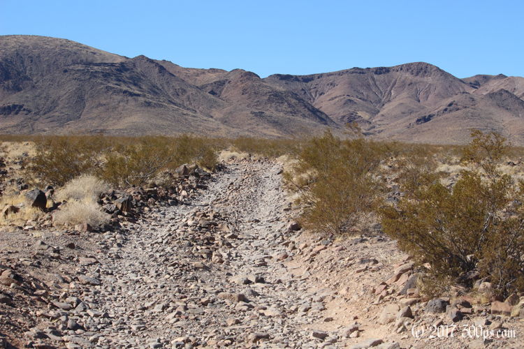
I'm able to ride most of the way to Gulch Road. Ironically enough, today's problemm is rocks rather than sand. Yesterday I would have given my left nut for rocks. Careful what you ask for, the rocks cause as much trouble as the sand. I walk a good portion of the road from Gulch to Fort Piute. The fort is an old Pony Express outpost that they only used for 6 months before changing the route somewhere further south. The stone walls of several buldings are all that is left.


Here the road ends and turns into a foot path. I wasn't expecting that, my maps say road. I keep going in spite of it all, dragging the bike up the rock-strewn path that follows the ridge of the canyon. It's amazing to see all the trees and vegetation that thrive off of this water source in the middle of such a harsh environment. Truly an oasis in the desert.


I reach Piute Springs canyon and pitch the tent. I'm done dragging the bike for the day. I walk a ways up the canyon just to be sure there actually is running water. I see a few small puddles, good enough for me. I'll go all the way up to the spring tomorrow. A big dinner and it's lights out.


