


| Distance | 54.86 kms | 34.18 miles |
|---|---|---|
| Climbed | 1,023 meters | 3,356 feet |
| Ride time (hours) | 4.70 | - |
| Avg speed | 7.2 kph | - |
| Avg climb | 4% | - |
| Max grade | 19% | - |
| Distance | 25,603.62 kms | 15,909.58 miles |
|---|---|---|
| Climbed | 268,941 meters | 882,352 feet |
| Ride time (hours) | 1,810.46 | - |
Friday, April 11th, 2014
Even though I'm at a much higher altitude than I've been for the last few days it feels warmer overnight. I'm a long way from any kind of services so I make a pancake breakfast before setting off. I backtrack down the dirt roads to the highway, then make the turn into Natural Bridges not far down the road. The entrance fee is 3 dollars. They have a dry campground with water at the visitor's center. I'm just going to ride the loop and hike a little bit so I don't check out the campground.


At the overlook for the first bridge I get to talking to a couple from British Colombia. The guy does 1 to 2 week camping trips on his bike, he has a BOB trailer that he ships ahead with his bike by bus to a destination then rides it back home. I've been curious about those trailers for a while, I wonder if it is a better setup than all the panniers. I wonder how they hold up on the off-pavement riding. He gives me a bunch of fruit and granola bars; this actually really helps me out, I won't have to break into my meager food supplies until tonight which will allow me to do some exploring of the dirt roads in Manti-La Sal National Forest.


Back at the visitors center after riding the loop and doing some hiking, I take a picture of some posted BLM maps of the national forest. I ride back out towards the main road then take the dirt road heading north up towards Bears Ears. It's a tough climb with loose sand and steep grades but it doesn't last all that long, maybe 2,000 feet of elevation gain that tops out at 8,500.


The road winds right between the two ears then descends a little bit onto yet another mesa, this one with tall Ponderosa pine trees and the occasional patch of snow. It has been an interesting process to watch the environment change as I climb up this staircase of mesas.


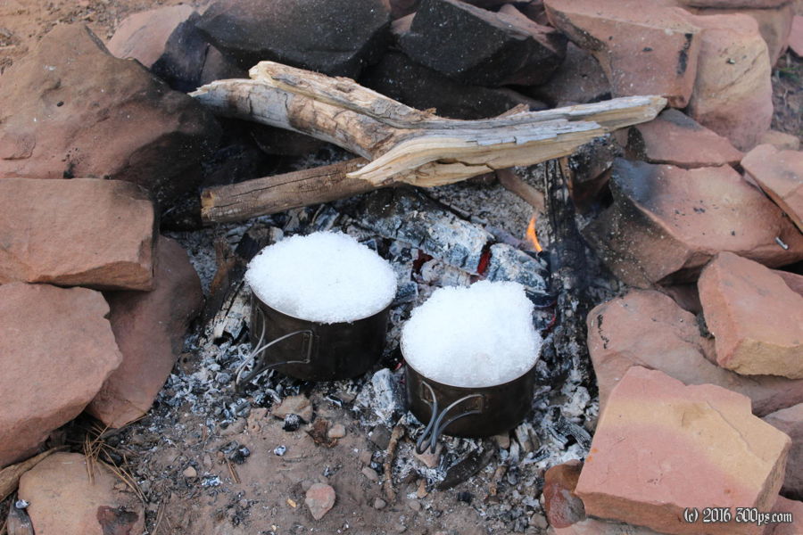
I ride another 5 miles or so until I stumble upon an incredible campsite overlooking Arch Canyon. No question, this is where I stop for the night. I cook all of my remaining food (some garlic, one fresh chile, pasta, and mix it all together with my emergency chile mac backpacker meal), this will have to be tonight's dinner plus tomorrow's breakfast and lunch. I set the pot with the cooked pasta down to do something else, when I turn around I knock the pot with my foot, sending all the pasta flying into the dirt. This all the food I've got so I'm not letting it go to waste; I pick it all out of the dirt and rinse it off as best I can. Now I'm in the hole with water from all that I use to wash the pasta, but there's snow up here. I fill a couple of pots with it and melt it on the fire. Tastes like charcoal but does the trick. I feel blessed to be eating my somewhat crunchy dinner and drinking my charcoal flavored water in such a beautiful place as the last rays of the sun paint the canyon below.


