


| Distance | 80.60 kms | 50.33 miles |
|---|---|---|
| Climbed | 546 meters | 1,791 feet |
| Ride time (hours) | 5.30 | - |
| Avg speed | 15.3 kph | - |
| Distance | 2,729.87 kms | 1,696.34 miles |
|---|---|---|
| Climbed | 20,630 meters | 67,684 feet |
| Ride time (hours) | 206.77 | - |
Monday, November 27th, 2017
I spent yesterday lounging around, watching football, and overeating. I thoroughly enjoyed it. Time to get back on the road, I pack up and head down to the Safeway for supplies. I figure I've got a three-day ride to Phoenix, probably two nights of camping, and maybe a motel somewhere on the eastern edge of the city to set me up for the final ride to North Phoenix. In front of the supermarket I run into a couple on a tandem with Ortlieb bags on the back. They are from Boston, out here doing a "rain-free" credit card tour. I'm intrigued by their tandem, the frame actually comes apart and fits into a suitcase. I think they are the only other touring cyclists I've met on this trip.


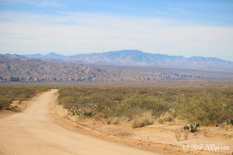
I'm relieved to see from the map that there is a back way to avoid I-10 and get onto Cascabel Road. I ride north out of Willcox, then turn west after the airport. The pavement gives way to a graded dirt road, some steep climbs at various places but generally pretty easy to ride. I leave the tires pumped up to full pressure.


When I get up to the pass over the mountains bordering this valley I see that I've got a long descent ahead of me dow to the San Pedro River. It goes really fast, I pay for leaving the tires at full pressure with some white-knuckle moments when the road turns soft with sand in the washes. I'm gripping the handlebars with all my strength to keep the wheels straight, occasionally slipping and sliding at high speed but I manage to get to the bottom without falling. I've dropped about 1,500 feet of altitude in the last five miles; glad I'm not going in the other direction.


I spend the rest of the day riding north along the San Pedro River wash, an up-and-down roller coaster of a ride, but with a pretty good packed dirt surface. Most of the land appears to be private ranchland complete with barbed-wire fences. I'd like to get down to the river at some point to camp but it's not looking likely without trespassing.


Towards the end of the day I find an unfenced section of land on a small plateau that overlooks the river. A fence blocks me from going any further, but I'm well-hidden from the road in a kind of mini valley nestled between tall rock outcroppings. I set up the tent and make dinner. It is significantly warmer tonight at this lower altitude, I'm happy to not have to get into the sleeping bag fully cloathed tonight.


