Ban Bor Thor: cave kayaking


Statistics for today
Distance 43.80 kms 27.34 miles
Ride time (hours) 2.30 -
Avg speed 19 kph -
Statistics for trip to date
Distance 1,147.00 kms 712.71 miles
Ride time (hours) 57.48 -
On this page

Monday, December 12th, 2016

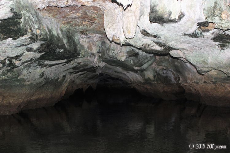
Trading the bicycle for a kayak to explore the limestone caves and karsts of Ban Bor Thor. Like most days I plan on not riding, I end up riding anyways, this time to see the sunset on a lonely beach 20 kilometers southwest of where I'm staying.

One of the French guys actually lives here and does guided tours. Last night they sold me on a kayak trip to see the limestone caves and mangrove swamps of the national park nearby. I have breakfast with the guy from Alsace who is heading to Phuket today. Everyone else is still crashed, probably to recover from all that drinking. The guide comes by at 10:30 and we hop on a scooter to go to the pier where the kayaks are.

Click for a larger version of the picture
Setting off.
Click for a larger version of the picture
Mangrove swamp.
Click for a larger version of the picture
Into a cave.
Click for a larger version of the picture
Coming out the other side of the karst.
Click for a larger version of the picture
Another cave.
Click for a larger version of the picture
Tough to capture the majesty of this place with the camera. A roughly circular pool surrounded on all sides by 100 meter+ cliffs.
Click for a larger version of the picture
Massive palms trees on the banks.
Click for a larger version of the picture
Back into the mangrove swamps.
Click for a larger version of the picture
Stalactites in another cave.
Click for a larger version of the picture
Pictographs dating back 3,000 years.
Click for a larger version of the picture
This pictograph is a symbol used for the area, I see it on signs everywhere. People can't agree on exactly what it represents.

At the last cave we run into a bunch of other kayaks coming and going. The guide sets a goal: make it back to the pier before everyone else. Some kayaks have a large headstart, but we crank as fast as we can and manage to beat everyone back. I'm going to be sore tomorrow.

Click for a larger version of the picture
I have lunch with the French guys at a restaurant next to this river. Beautiful spot.

I want to see the sunset on the west coast, I'm suspecting that it will be good, so despite my pledge to take it easy I'm back on the bike to ride the 20k to the beach.

Click for a larger version of the picture
Taken from Laem Sak, the end of the pensinsula Ao Luek is on.
Click for a larger version of the picture
Beach northwest of Laem Sak
Click for a larger version of the picture
My first west-coast sunset. It is impressive.

I have to do the return 20k in the dark. Never a good idea, as usual I take a few bugs in the eyes. I arrive back in Ao Luek famished. I stop at a street stall to pick up dinner to go, ride back to the bungalow and wolf it down. The owner invites me to some kind of party where the others are hanging out but I'm knackered. A thorough shower then it's bedtime for me.

Click for a larger version of the picture
My dinner that I bought at a road-side stand on the way back from the beach. Noodles with stuff, not exactly sure what. It came with an excellent soup.
Click for a larger version of the picture
The bungalow common area. All quiet tonight, last night it was hopping.