


| Distance | 36.00 kms | 22.37 miles |
|---|---|---|
| Climbed | 1,126 meters | 3,694 feet |
| Ride time (hours) | 6.91 | - |
| Avg speed | 5.2 kph | - |
| Distance | 218.60 kms | 136.08 miles |
|---|---|---|
| Climbed | 3,664 meters | 12,021 feet |
| Ride time (hours) | 20.47 | - |
Thursday, April 25th, 2019
Hidden away from the sun in my little canyon, I could sleep in this morning but I suspect I have a very long day ahead of me. I pack up and filter a full compliment of water for the road, just in case. It's going to be a warm one.


The better part of the morning is a continuation of yesterday: climbing up and over progressively larger hills, slowly gaining net altitude as I move north. Then the "road" turns east, following a mostly dry river bed. Here the going really gets tough. To avoid canyon walls the path constantly criss-crosses the stream. Since the bed is sand or very loose rock, I'm walking the bike over every crossing. Often it is difficult to find where the road picks up on the other side because it is overgrown with grass and brush; and at these fords the road actually is the river bed for a significant stretch. Several times I have to back track or walk up and down the river until I find the continuation of the road. Google maps is of dubious assistance as to the exact location of the road. Maybe the data was never very good, maybe the road has moved to adjust for changes in the river path, maybe it's the inexact nature of GPS... or probably a combination of all the above. At every moment of doubt I do manage to eventually figure it out. The one stresser is the fact that OSM and Google don't agree on how far the road goes. I am apprehensive that OSM will be right that the road ends and I will have to turn around.


By early afternoon I am well past the point that OSM says the road ends. The road hasn't ended so I should be okay to get through to San Carlos Lake. I'm really putting some work into this "ride": drag the bike across a river, push through some brush, climb up steep and rocky grades, bomb down the other side trying not to crash when the wheels get stuck in deep sand.

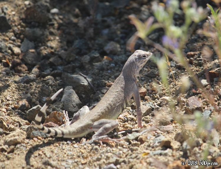
On one of these sections of overgrown road I come face to face with near death experience #59: as I ride the long grass just in front of me starts to rustle. I catch a glimpse of thin, light-brown skin... it's a snake. I drop the bike and jump to the right as the rattler emerges from the grass to my left, head raised and ready to strike. Oh shit it's a Sidewinder. In this split second I calculate what will happen if he bites me: I've got no service on the cellphone out here, I'm at least a day's walk to get anywhere -- in short, if he gets me it's mostly likely game over for me. The bike is between us, however; it seems like he considers a strike, realizes he won't reach me, then slithers off into the bushes. I would like to get a picture but it all happens too fast and I won't be going looking for him. I take a break to let my heart rate settle back to something near normal.


Later in the afternoon I've left the river heading north. This section is just pure climbing. I get high enough to change ecosystems: round about 3,500 feet the cacti give way to pine trees.


When I reach the top of the pass I conclude that my plans to reach the lake by the end of the day are a pipe dream. Even though I'll be losing elevation for the rest of the day, the road hasn't gotten any smoother and it is winding all over the place. To top it off one of the eyelets on the bike frame that holds the back rack breaks off. Fortunately there are two eyelets on each side, I have to stop to move the rack down on the remaining eyelet. I lost the bolt when it broke so I scavenge one of the bottle cage bolts that I'm not using to reattach rack.


After a few hours of skidding down these hills I give up at the first sight of water. I pitch the tent on some grass, make a huge dinner in the twilight, then collapse in exhaustion into my sleeping bag. Strava says my average speed for the day is just over 3mph. 22 miles in 7 hours of ride time.
I haven't seen a single person since I made the turn off route 77 yesterday. I'm working on a 36-hour no human being streak.

