


| Distance | 103.59 kms | 64.62 miles |
|---|---|---|
| Climbed | 642 meters | 2,106 feet |
| Ride time (hours) | 6.12 | - |
| Avg speed | 10.5 kph | - |
| Avg climb | 2% | - |
| Max grade | 20% | - |
| Distance | 25,905.15 kms | 16,096.62 miles |
|---|---|---|
| Climbed | 271,553 meters | 890,922 feet |
| Ride time (hours) | 1,830.63 | - |
Tuesday, April 15th, 2014
It takes a while to get out of town this morning. I go back to the library to get on the internet, then stop by the sheriff's office to ask about riding bikes on the I-70. They tell me it's ok as long as there is no alternative which appears to be the case for a good stretch on the way to Grand Junction, Colorado.
I call Tuba City one more time to see if anyone has turned in my laptop: no dice. I have to go to Grand Junction to get a new one, it's the closest place that has big-box stores.

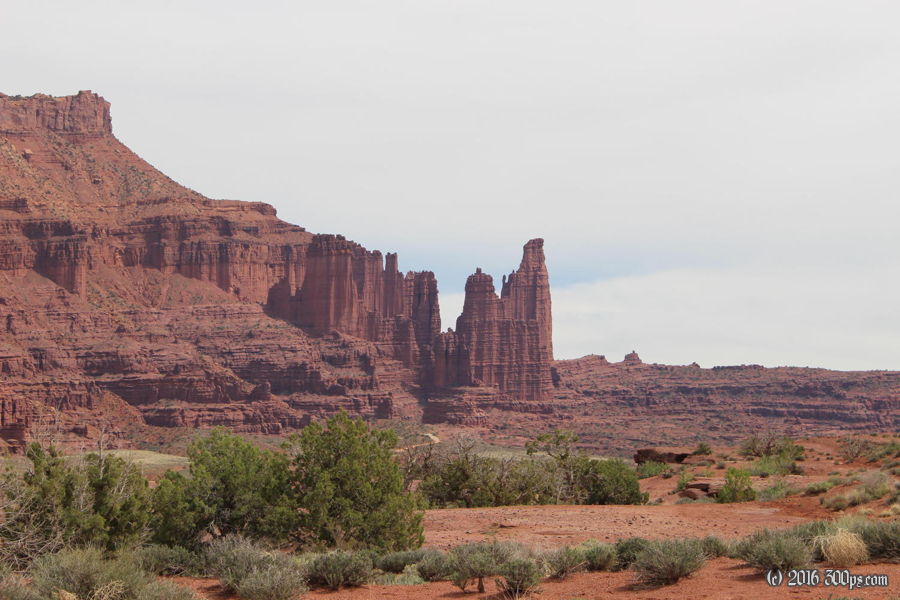
I ride up 128, the road that follows the Colorado river north to I-70. It's a scenic route through red rock canyons. There are some nice looking campgrounds along the river, all with "Full" signs, probably due to this Jeep Week thing. The riding is pretty easy with very little climbing and not too much wind until I exit the canyons on the north side.


Once I'm out of the canyons the wind hits me hard from the west. I struggle for about 10 miles until I reach the junction with the road towards Cisco, from there I fly along to the east with the wind pretty much right at my back.


Cisco is nothing but some abandoned houses and a few trailers that look like they might be occupied. This area seems to be a natural-gas producing zone. At I-70 I get on an unmarked road that parallels the highway. After a few miles it turns into a dirt track. I hang in there for a few more miles but I run out of daylight and energy so I head south across some fields and set up camp in a thicket of bushes. As I go to make dinner I realize that water has become a problem again: I lost a liter bottle, probably on that bouncy dirt track. Since pasta is the only thing on the menu I'm stuck drinking the grey water to not get dehydrated.


