


| Distance | 71.00 kms | 44.12 miles |
|---|---|---|
| Climbed | 1,672 meters | 5,486 feet |
| Ride time (hours) | 5.41 | - |
| Avg speed | 13 kph | - |
| Distance | 360.20 kms | 223.69 miles |
|---|---|---|
| Climbed | 6,628 meters | 21,745 feet |
| Ride time (hours) | 31.59 | - |
Saturday, April 27th, 2019
I feel pretty good this morning after last night's shower, big meal, and deep sleep in a comfortable bed in an air-conditioned room. I'm feeling good enough to tackle Pioneer Pass just to the south of Globe which is sure to offer a long climb on dirt. First things first, however: I need coffee and breakfast. I pack up and say my "au revoirs" to the motel owner.


I head out of town towards the pass. It's Saturday; there are lots of people out and about in their off-road vehicles. As I start to head up the pass there is a long line of them forming to make a convoy up the mountain. Unfortunately I get ahead of them, then have to deal with all the dust when they pass me later. Of course there are a few wankers who cut too close to me.

Although the pass is a significant climb -- about 3,000 feet from Globe to the top -- it feels pretty easy in comparison to what I was doing in the San Carlos Apache Reservation. The dirt road is smooth and the grades aren't too tough, it's just a question of being patient and pushing the pedals.


It takes me a couple of hours to get to the top. I'm treated to a beautiful view of the surrounding valleys. Now I've got a long downhill in front of me, free of the weekend warriors who won't be venturing into the backcountry on this side of the pass.


After a few miles of descent I run into a gate on the road that Google wants to send me down to get to route 77. I still have cell service from the towers on top of Pinal Peak; I take advantage to plan a different route that should take me to Dripping Springs then through to route 77. It's a longish ride. Once I get down the mountain I'm back to climbing up and down hills on a rough and rocky path that slows me down quite a bit. It gets hot when I give back most of the elevation I gained climbing the pass.


At Dripping Wells I pick up a smooth dirt road that allows me to speed up considerably. Then I hit the pavement at route 77. I pump up the tires again to pavement-appropriate pressure and cruise with the wind towards Winkelman. This road follows the Gila River through smallish canyons. It reminds me a bit of the Salt River, although not so steep and dramatic.

I roll into Winkelman all hot and sweaty. I buy myself a huge cup of ice and powerade to cool off along with a gallon of water for tonight's camping. I sit on the curb in the shade next to the gas station and rehydrate. A number of motorcyclists are out for a Saturday ride from Phoenix. I chat with a bunch of them. One guy on a BMW R1200 GS tells me about his plans to go to South America. I tell him about my experiences crossing from Panama into Colombia. He wants to sell this bike (too heavy) and buy a light Honda twin. I agree with him about the weight; the R1200 is a beautiful bike but it is too heavy to do hardcore offroad. If you drop that thing alone in the backcountry you're screwed.

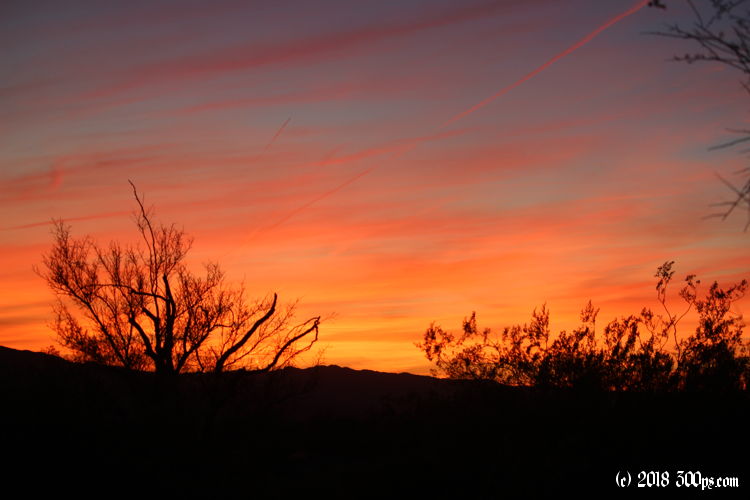
It's about an hour to sunset so I head out of Winkelman to camp. I turn left up the road I took the other day to get into the Apache Reservation, knowing there will be some nice secluded spots not too far from the road. I find a flat place to pitch the tent on top of a hill hidden by a stand of manzanita bushes and set up shop. I make dinner and watch the sunset... another beautiful display of red and orange against the backdrop of saguaros, manzanitas, chollas, and nopales. I'm feeling fat and happy after my huge dinner and a dose of nature's 100% organic fireworks display.


