


| Distance | 37.60 kms | 23.61 miles |
|---|---|---|
| Climbed | 593 meters | 1,946 feet |
| Ride time (hours) | 3.76 | - |
| Avg speed | 15 kph | - |
| Distance | 37.60 kms | 23.61 miles |
|---|---|---|
| Climbed | 593 meters | 1,946 feet |
| Ride time (hours) | 3.76 | - |
Monday, April 22nd, 2019
A free week in Tucson, what better time to take off to the backcountry desert for a litte exploration. I've had my eye on the San Carlos Apache Reservation for a few years now but haven't yet had the opportunity to get up there. The weather looks favorable -- nothing severe in the forecast and not too hot -- and the wetter than usual winter will probably have left enough water around to support a deep dive into the uninhabited expanse of the reservation.

I had plans on an early start (and to go over Mount Lemmon), but after I was through fiddling with my gear and having breakfast I didn't get on the road until after noon. That changes my ideas about Mount Lemmon. I'm not sure how long it would take to climb with a fully-loaded bicycle but it surely wouldn't be quick; and I wouldn't want to get stuck camping off of the paved road. So I opt for Redington Pass instead. The pass is just the continuation of Tanque Verde road heading over a lowish section of the Catalina Mountains into the San Pedro River valley. I'm familiar with that valley from a previous trip.


When the pavement stops and I'm climbing up the steep, dirt switchbacks of Redington Pass I'm glad that I opted for this route rather than Mount Lemmon. Although I've been cycling every day I haven't been pushing a 75lb bicycle around. There is a difference. My knees feel a bit creaky. I decide to stop to camp at the top of the pass; a short day should give my body more time to acclimate to the effort needed to drag this mastadon up the hills.


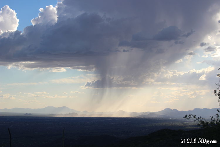
I find a good spot of flattish ground on the top of a hill above the road. I'm overlooking Tucson but hidden from view from the road. I set up and relax for a while, enjoying the sights. Dinner comes out excellent as it usually does on the first day -- everything is still fresh.


